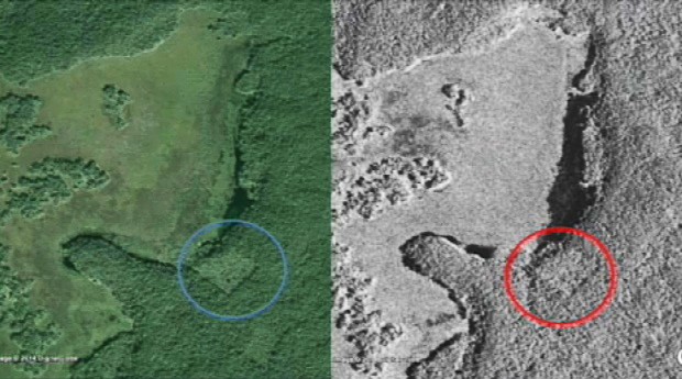
Man-made structures such as the Maya temples could cause such features in the images. But so could old abandoned agriculture fields, for example (or something else). Only a field expedition could give a true validation of this hypothesis, which could become a very difficult and expensive process.
This is where GIS and remote sensing can play a very important role. For example, if the features were indeed caused by an old agriculture/corn field, satellite images of 5, 10 or 20 years ago could help explain the nature of the observed features. Spatial data and maps of communities that live around that area (if they exist) or maps of agriculture activities in that area would also help us understand whether the features could be caused by recent activities.
All this information (satellite images and maps) can be displayed and analyzed using free open source or proprietary GIS software.
5 great uses of GIS
The application of GIS has no limitations, as long as we have spatial information (location, location, location!).
GIS can play a powerful role in assisting scientists, business specialists and community organizations validate hypotheses and communicate information and research from many domains.
- Biology and environmental health specialists, for example, may want to map the distribution of the Zika vector (mosquitoes) habitat worldwide. Will increasing temperatures push the boundaries of those habitats?
- An urban planner may want to map green spaces in the city to evaluate the need for increased green areas.
- A high school teacher may want to teach history classes using GIS storytelling: attaching dates to places and photos; all on Google Earth for example.
- An NGO may want to collect information from aboriginal communities to map the most important lands, according to them (participatory GIS).
- A transport company may want to know if their existing routes are actually covering the needs of the consumers. Where would new services be needed?
GIS helps us to understand places, to detect and understand spatial patterns and to determine relationships between variables over time and space. GIS plays an important role in bridging multiple disciplines, and in enabling collaboration using one platform.
Concordia’s Department of Geography, Planning and Environment is offering a new Summer GIS Certification program entitled Learning GIS Through Practice from May 30 to June 3. Space is limited, so sign up now!


 This ingenious use of GIS generated global excitement. | Photo by William Gadoury
 Concordia's Angela Kross | Photo by David Ward