Navigating a plane from your desktop
Thanks to a successful collaboration at Concordia, simulating the experience of being an aircraft pilot is now as easy as using a joystick with a computer that has an Internet connection. Ensuring a safe landing though — that part is still difficult.
“To successfully do flight simulation, you need to see what a pilot would see,” explains Luis Rodrigues, associate professor in the Department of Electrical and Computer Engineering and an expert on flight control systems and navigation. His collaboration with Kyungjae Baik, previously his master’s student and now a successful alumnus, resulted in a flight simulation tool that makes use of Google Earth’s vast archive of photos of our planet. This new tool was publicly unveiled at the recent e.SCAPE: Knowledge, Teaching, Technology conference, hosted at Concordia.
Baik, the computer mastermind behind the project, says it took about six months to complete. He had all the skills and knowledge required, not only because of his Concordia training but also because of many years working in the software industry with IBM in South Korea.
“The motivation was to have a platform for aerospace engineers to work on that was accessible and fun at the same time,” he says.
The key challenge for Baik was to integrate Google Earth with two additional vital tools, MATLAB and Simulink, standard computer software used by universities for research. These tools can provide information about an aircraft’s location. Baik programmed a sophisticated interface that allowed the information from MATLAB and Simulink to be shared with Google Earth. The end result might look like a video game, but the goals are serious.
“As an engineer, this means you can experience the effect of the algorithms that you write for aircraft,” says Baik.
The Google Earth flight simulation is quite a thrill ride, and when Rodrigues opened the doors of his lab at e.SCAPE, the “cockpit” of the new invention was seldom empty. The invention was tried by students and simulation professionals alike. Several high school students entered the darkened room and one girl asked if she could give the simulator a try. She was soon sitting in front of three large computer screens, watching the rounded contour of the earth’s horizon careening closer and closer. She subsequently crashed.
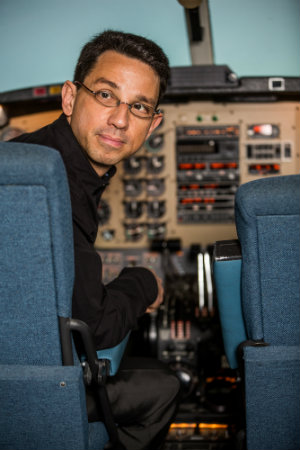
Rodrigues, who first came to Concordia in 2003, was instrumental in first bringing a flight simulator to the university in 2007, and it has been in active duty in the basement of the Henry F. Hall Building ever since.
Built and donated by the Montreal company Mechtronix, which was started by Concordia alumni, the simulator gets many hours of use, but is expensive, and so must be monitored carefully to keep it safe. Rodrigues is delighted that the new Google Earth simulator provides an experience that gives training opportunities to a greater number of students and at a low cost.
For his part, Baik has gone on from his Concordia education to join the same company, Mechtronix, whose donated flight simulator currently sits beside the new Google Earth simulation. He graduated in January 2012, has become a permanent resident of Canada, and works out of an office on St-Laurent Boulevard in Montreal.
Watch Rodrigues deliver a seminar about the flight simulator to Marianopolis students:
Related link:
• Faculty of Engineering and Computer Science