Program type
Minor
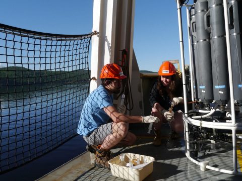
It’s what powers Google Maps but its application goes far beyond. Master Geographic Information Systems (GIS) technology to the point of making your own maps, and you’ll gain the power to see and understand a specific location in a way that allows you to forecast issues and solve problems. An oil spill hits a river: where will the pollutant go next and how bad will the damage be? You’re opening a new bike shop: what’s the best location given existing bike stores and the flow of bicycle traffic? You want to map the migration journey of your parents: what is the best available online mapping application for telling and sharing spatial stories? You’ll also become a more savvy producer of maps as you take a critical approach to understanding the choices behind presenting data sets in visual form.
The Minor in Geospatial Technologies is open to students in all Faculties.
The Certificate in Geospatial Technologies is designed for students who wish to advance their career but are not currently enrolled in a degree program.
United States students: A U.S. Federal Student Aid-eligible version of this program is offered. This version meets all U.S. regulations (such as no co-operative education or e-courses) for eligible programs.
Minimum cut-off averages should be used as indicators. The cut-off data may change depending on the applicant pool. Applicants who meet the stated minimum requirements are not guaranteed admission to these programs.

Deadline: March 1
U.S. and international applicants: Apply no later than February 1 to allow time for immigration document processing. However, applying earlier is strongly recommended. Immigration processing times vary by country and delays could prevent you from starting your studies on time.

Deadline: November 1
U.S. and international applicants: Apply no later than August 1 to allow time for immigration document processing. However, applying earlier is strongly recommended. Immigration processing times vary by country and delays could prevent you from starting your studies on time.
We reserve the right to close admission to a program at any time after the official deadline without prior notice.
Thanks to Concordia's emphasis on taking an interdisciplinary approach to your field of study, you'll graduate with a depth of knowledge informed by an understanding of how your subject connects to the wider world. You'll be ideally positioned to succeed in a professional role that demands rigorous analytical thinking, sharp communication skills and the ability to approach problem-solving from multiple dimensions.

Bachelor of Arts Honours History: Public History
Find out how Scarlet Guy discovers a world of interdisciplinary learning and community support in the Faculty of Arts and Science.
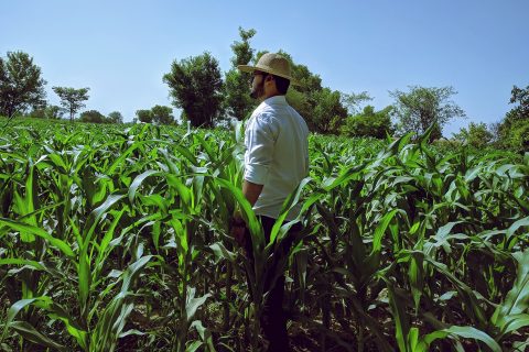
If you are fascinated by the science behind how human activity affects our planet, and passionate about creating a more sustainable future, the Environmental and Sustainability Science program is for you.
Departments
Department of Geography, Planning and Environment, Department of Chemistry and Biochemistry, Department of Biology
Faculty
Explore how geography influences human behaviour and examine the impact of human activity on the environment.
Department
Department of Geography, Planning and Environment
Faculty
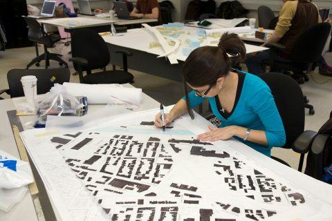
As an urban studies student, you’ll explore how residential and commercial areas, community spaces, public services and transportation all function together. You’ll learn how to make decisions in the public interest, and plan for future change.
Department
Department of Geography, Planning and Environment
Faculty
© Concordia University