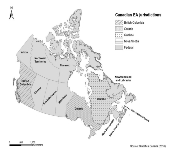
Pathways for improving the consideration of ecological connectivity in environmental assessment: Lessons from five case studies.
Patterson, C., Torres, A., Coroi, M., Cumming, K., Hanson, M., Noble, B.F., Tabor, G.M., Treweek, J., Iglesias-Merchan, C., Jaeger, J.A.G.(2023). Pathways for improving the consideration of ecological connectivity in environmental assessment: Lessons from five case studies. Impact Assessment and Project Appraisal, in press. https://doi.org/10.1080/14615517.2023.2246727